Day 18 — Monday 16 May 2011
Cantalejo – Ayllon
| Route Details | ||
|---|---|---|
| Riding Distance | 36.45 ml | 58.67 km |
| Uphill Distance | 13.12 ml | 21.12 km |
| Downhill Distance | 15.40 ml | 24.79 km |
| Max Altitude | 3503 ft | 1068 m |
| Altitude Gain | 1286 ft | 392 m |
| Altitude Loss | 1188 ft | 362 m |
The night was cold and I didn’t sleep very well, perhaps because there was no cloud cover, or maybe I was quite high up at 3,500 feet, or perhaps it was still mid May. In the morning I tried to boil up some water for a hot drink but my camping stove refused to light properly. I’d had my Sigg Firejet stove for many years and sometimes it had not lit at first go, usually because I’d not got the combustion tubes hot enough to vaporize the petrol. I took it all to bits, pricked the jet, cleaned it thoroughly but still it would not ignite so I binned the lot including the fuel bottles that would now take unnecessary space. I wondered what to do with the fuel, and in the end found a secluded part of the site where I could dig a hole in bare soil and pour it away.
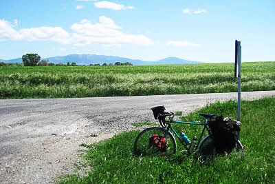
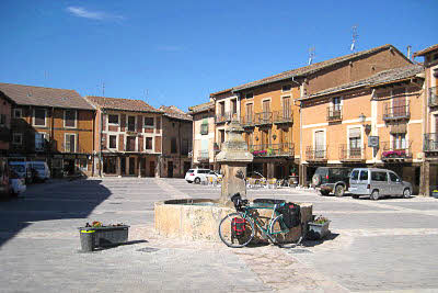
I felt really tired that morning. Maybe that was partly the cause of my frustration with the cooker. I set off slowly and climbed up to a plateau that continued for a few kilometres before dropping down to Sepulveda. I stopped overlooking the town from the other side of a steep valley. I took a photograph of my bicycle propped up against the panorama sign and later I’ve found the same place on Google Street View; quite intriguing really. I wormed my way round the bottom of the valley and back up the other side to the town itself. The road passes through pedestrian squares and streets and I got lost. I didn’t realise it until I looked at it in Google Street View but there is an underpass taking the main road through the town without disturbing its peace and quiet.
The route map on this page shows my intended route, but as I came out of the town I realised that I wasn’t travelling in the right direction as the sun was in my face. Clearly I was going South East and I should have been travelling North East, so rather than trying to retrace my steps I carried on to Duraton and then turned North towards El Olmo. I came to a wide dusty cross roads with the tiny hamlet on the right hand side and a road leading back to Sepulveda on the left that I ought to have been coming down, and on the junction there was a large new building with “Restaurant” painted in huge letters on its roof. In fact I had forgotten that I had stopped there until seeing it on Google Street View. Lunch was good.
I cycled on along lightly undulating small roads with the Sierra de Ayllon filling the horizon on my right. I approached Ayllon through its modern commercial outskirts that were not all that inspiring. The old town nestles behind its imposing wall and town gate, and just before crossing the river that would have given it some defense I found a hostal bathed in late afternoon sun. I pulled up and had a large Coca Cola sitting under a red umbrella listening to mothers chatting about their children. I was able to take my bicycle into the lobby for safe keeping. The room was comfortable and the shower hot. I walked into the old town and had a drink and some supper in a bar where an enthusiastic crowd had gathered to watch a bull fight. It could easily have been a football match for all the noise they were making.

Route – Day 18
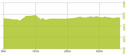
Gradient – Day 18
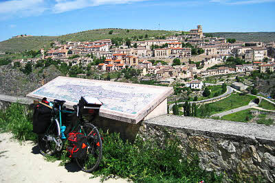
Looking over Sepulveda – World Heritage Site (12:25)
Sepulveda (Google)
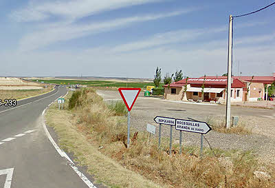
The restaurant at El Olmo (Google)
Looking SE to Sierra de Ayllon; Madrid is on the other side (15:29)
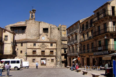
Ayllon, the old town square (Tue-17-May 10:11)
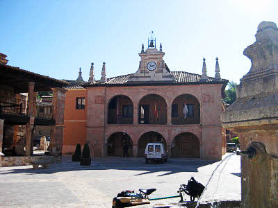
Ayllon, the other side of the square (Tue-17-May 10:12)