Day 10 — Saturday 7 May 2011
Belalcazar – Puerto Peña
| Route Details | ||
|---|---|---|
| Riding Distance | 50.19 ml | 80.77 km |
| Uphill Distance | 20.16 ml | 32.44 km |
| Downhill Distance | 23.33 ml | 37.54 km |
| Max Altitude | 1822 ft | 555 m |
| Altitude Gain | 2759 ft | 841 m |
| Altitude Loss | 3317 ft | 1011 m |
I found a mini supermarket at the edge of the town and bought provisions for the day and set out at about half past nine. It looked like rain. I dropped down to the foot of a ridge that I then had to climb up to Cabeza del Buey. The road went through an extraordinary expanse of pancake-flat green cultivated wilderness, on and on for miles with hardly any traffic. There was a rain cloud in front and depressingly I was catching it up. I thought it was going to blow across in front of me but its trailing edge just caught me. I donned my wet weather gear. I rode into and out of the rain three times, each time drying out before the next dousing.
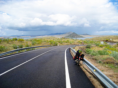
I came down to the first of two causeways crossing the Embalse de la Serena and then to the second that crosses the lake and then goes round an extraordinary conical hill on a one-way system. The hill looks just too regular to be natural, I don't know.
At Pueblo de Alcocer a bar did me an impromptu plato combinados caliente (a plate of hot ham, chicken, fried egg and bread) that filled me up for the afternoon.
I was heading for Telarrubias where Michelin has a camp site marked. I came to a blue triangular camping sign pointing straight on for two kilometres so I followed it hopefully. Where I was hoping to find the camp site I came to another sign for Puerto Peña Camping so on I went, and on, and on, for a very trusting 16 kilometres when suddenly the camp site signs started again (much to my relief) and led me to a spectacular hydro-electric dam that spans the gorge. The ridge it cuts through is visible on the map. I stopped to ask some workmen in a van parked up in a lay-by who gestured me over the dam. I followed the road and more campsite signs alongside a dual carriageway, round and under it and down a rough track to the most superb campsite. It was really well appointed, basking in sunshine and with quite a few people that made a difference.
It was good to have other campers around after a couple of days in hostals. I said “Hello” to a couple in a campervan thinking they were from the Czech Republic as they had ‘CH’ on their number plate, but they corrected me: Swiss!
That day was supposed to have been a lightish day but it turned out to be one of the longest days of the trip. It was quite speedy, some bottom-gear work but no need to get off and push. The level, down hill sections were quite extensive and I was able to get into top gear occasionally.
At the bottom of the gorge where the camp site is situated mobile ’phone reception is poor, and I had to climb up to the top of a bird watching platform to send my text message to Liz.

Route – Day 10
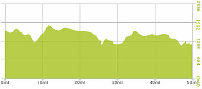
Gradient – Day 10
Embalse de Serena (12:56)
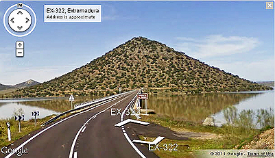
Conical Hill with one-way circular road (Google)

Conical hill with one-way circular road
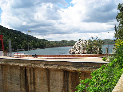
Embalse de Garcia Sola – Hydroelectric Dam (16:13)

Route over the dam to the Puerto Peña campsite
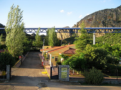
Campsite at Puerto Peña (20:11)
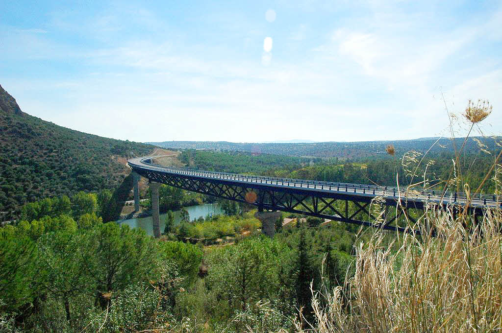
Viaduct over Campsite at Puerto Peña (Google)