Day 15 – Sunday 22 July 2012
Bremervode-Plönjeshausen – St Michaelisdonn
| Detail | Imperial | Metric |
|---|---|---|
| Riding Distance | 60.87 ml | 97.96 km |
| Start Elevation | 97 ft | 10 m |
| Total Ascent | 571 ft | 245 m |
| Max Elevation | 121 ft | 37 m |
Campsite
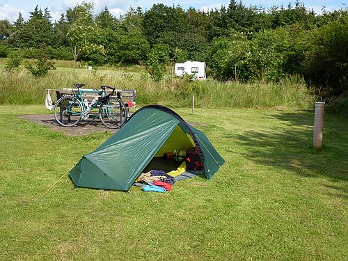
Hohenkamp Camping, Hopen 55, 25693 St Michaelisdonn, www.hohenkamp-camping.de/. (In my estimation this camp site comes dangerously close to perfection.)
Notes
Torfmann cycles from Brunsbüttel to Husum, but I stop short at St Michaelisdonn, having started quite a bit further south. Our distances are much the same.
There was a little rain as I set off from the Bremervörde-Plönjeshausen campsite, but it cleared up after a couple of hours. I dropped gradually downhill towards the Elbe, the going fairly easy along undulating roads. I was cutting across country from one small village after another. I stopped at a roadside petrol station with a Kleine Bistro for a sandwich and a coffee, there being nothing likely by way of a restaurant from what I could see from the map.
Eventually I came to Wischhafen and encountered a long queue of cars waiting for the ferry. I cycled slowly along the side of the queue up to the front, and found a number of cyclists and pedestrians waiting for the next ferry. There was no problem with us getting on first as we took up little room at the side of the deck. The crossing took about ¾ hour.
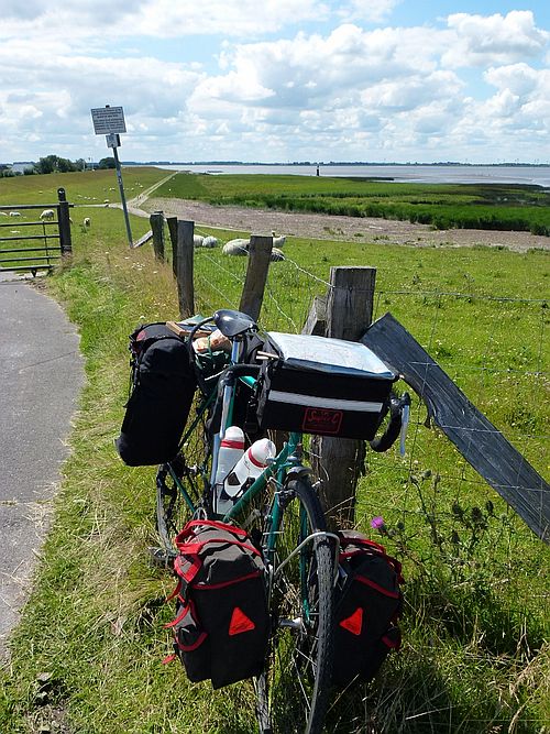
On the other side I followed the Elbe cycle way for part of the way before heading north west for Kudensee and the ferry over the Kiel Canal. There were huge sea dykes along the cycle way and lots of thatched houses and large farmhouses incorporating livestock sheds. There were lots of cyclists and walkers and the afternoon weather became perfect. There is a road bridge over the canal north of Brunsbüttel but from the map it looked formidable so I stayed away from it. The Kudensee chain-link ferry is free, operated by the Kiel Canal Authority and clanks its way across the canal between huge sea-going container ships making their way to and from the North Sea and the Baltic.
I followed the straight road to Dingerdonn and turned right steeply up hill towards the Verkehrslandeplatz (airfield) St Michaelsdonn. I passed the entrance to the airfield where small single engine aircraft were lined up on the grass. At the end of a short lane I came across the campsite, largely occupied by caravans, but with a large neatly mowed camping area behind what I can only describe as one of the best service blocks I have ever found. One of the caravanners explained that the owner was not around at the moment, but the keys for the doors into the service block were attached to magnetic fobs on the underside of the window sills and that it was the custom of the site to lock all doors as you left. I pitched my tent next to a couple of benches either side of a table at the edge of the camping field. I had an excellent hot shower, washed my kit and hung it between the benches to dry in the evening sun.
The owner eventually walked over to where I was camped and having booked me in offered me a cold beer from the fridge in the campsite kitchen. Now that's what I call a hospitable campsite!
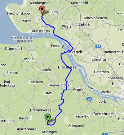
Route – Day 13
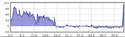
Gradient – Day 13
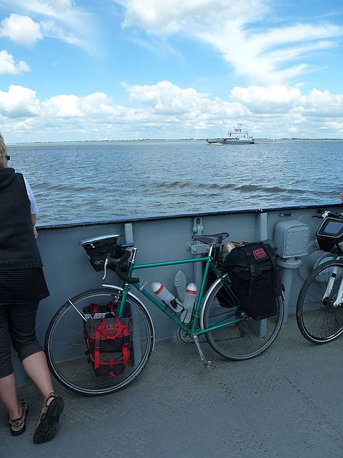
Crossing River Elbe – 22/7/2012 (12:45)
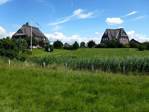
Characteristic thatched houses – 22/7/2012 (13:09)
Sea dyke – 22/7/2012 (13:26)
Hohenkamp Camping – 22/7/2012 (16:42)