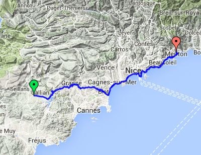
Day 8 – Sunday 6 July
Tourettes to Menton
| Route Statistics | ml / ft | km / m |
|---|---|---|
| Riding Distance | 61.64 | 99.2 |
| Total Ascent | 6558 | 1999 |
| Total Descent | 6234 | 1900 |
| Start Elevation | 699 | 213 |
| End Elevation | 374 | 114 |
| Min Elevation | 0 | 0 |
| Max Elevation | 915 | 279 |
Campsite
Camping Municipal Saint Michel (http://www.ukcampsite.co.uk/sites/details.asp?revclass=9211)
Notes
This was a really exhausting day. The hills were what I was expecting to Biot where I stopped at a street restaurant for a pizza made with a crêpe base: a bit odd but very tasty. The town was shut for a festival but I got through with my bicycle and should have headed downhill to the coast, but somehow I managed to get onto a main upper road that was busy and hilly. At one point I puffed up a one way street with no way off and a string of impatient cars behind. Eventually I got down to sea level at Villenueve-Loubet and came across huge holiday apartment blocks before cycling along the Avenue des Anglais at Nice. Wandering roller bladers and people on hire bikes kept getting in the way. The coast road then climbed over a series of headlands to the rear of Cap Ferrat, then through the centre of Monte Carlo and Monaco, which may be very attractive on their outskirts but otherwise are no more than rather grubby town-centres. Finally I got to Menton, and found that the campsite was high up overlooking the coast, at the end of a narrow road so narrow I had to walk part of it. It was on sloping ground, terraced on a number of levels with superb views over the bay below, but with quite a good restaurant where I had a meal of ham and melon. I met some motorbikers from Slovenia who had ridden there that day. Surprisingly it was nearer to their home than I was to mine.
Day 8 – 62 Miles
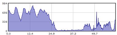
Gradient – Day 8
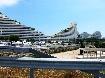
Holiday apartments at Villeneuve-Loubet (12:49)
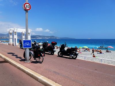
Promenade des Anglais, Nice (13:33)
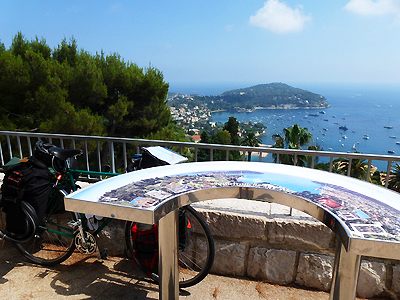
Overlooking Cap-Ferrat (14:36)