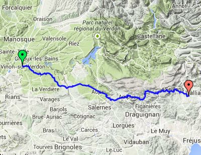
Day 7 – Saturday 5 July
Manosque to Tourettes
| Route Statistics | ml / ft | km / m |
|---|---|---|
| Riding Distance | 65.44 | 105.31 |
| Total Ascent | 8169 | 2490 |
| Total Descent | 8383 | 2555 |
| Start Elevation | 896 | 273 |
| End Elevation | 682 | 208 |
| Min Elevation | 673 | 205 |
| Max Elevation | 2343 | 714 |
Campsite
Camping le Grillon (http://www.campinglegrillon.com/)
Notes
I got away from Vinon at 09:00 and evetually got to Tourettes at 18:30. I had a pizza at a pleasant roadside restaurant at Aub. The route was pretty hilly with temperatures aound 25° so I was sweating a lot. Off the main roads the route was delightful with huge views across mountainous valleys receding into the distance. There were small “alpine villages” with a distinct Spanish/Italian look with “U” shaped roof tiles.
Once up to a height the small roads tended to follow the contours until there was a main road junction when the road swooped down and then climbed up again. The downhill free-wheels were exhilerating with hair-pin bends, but wearing on the brakes and tiring on the hands.
At the campsite the proprietor was a little surprised to see a lone cyclist. There was no site restaurant so I had to make do with the emergency rations I had with me.
Day 7 – 65 Miles
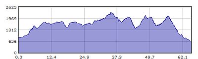
Gradient – Day 7
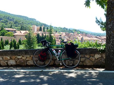
Probably somewhere near Aub (11:18)
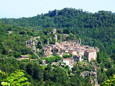
Bargemon (14:11)
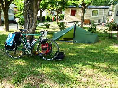
Camping le Grillon, Tourettes (17:08)