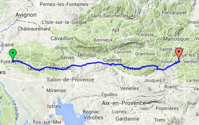
Day 3 – Tuesday 1 July
Fontvieille to Vinon-sur-Verdon
| Route Statistics | ml / ft | km / m |
|---|---|---|
| Riding Distance | 63.45 | 102.11 |
| Total Ascent | 3232 | 985 |
| Total Descent | 2480 | 756 |
| Start Elevation | 131 | 40 |
| End Elevation | 883 | 269 |
| Min Elevation | 20 | 6 |
| Max Elevation | 1329 | 405 |
Campsite
Camping du Verdon (http://www.campingduverdon.fr/)
Notes
The weather was good throughout the day as I carefully rode east into the foothills of the Maritime Alps, nursing my damaged pannier carrier tied together with string. I'd bought a baguette and cheese before I set off and sat in the sun for lunch. Later in the day I crossed the Durance for the second time at Mirabeau, where the bridge has been rebuilt several times over the centuries, most recently after being distroyed by the French resistance in 1944. I was heading for my planned campsite at Vinon-sur-Verdon when I happened to pass a nuclear energy installation at Cadarache as everyone was streaming out. I fell in with a cyclist heading home to Manosque who told me there was a good bicycle shop there. Eventually finding the campsite off the road down by the river I had to wait while a couple already camping there opened the security gate and let me in to the site office. I pitched in the pine trees and walked into the town to find something to eat.
Day 3 – 63 Miles
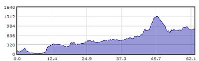
Gradient – Day 3
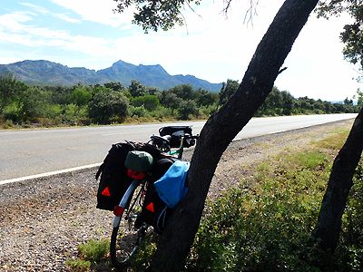
Distant view of the Maritime Alps(08:53)
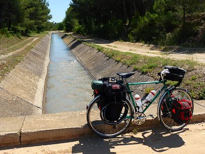
Huge irrigation/drainage channels (11:08)
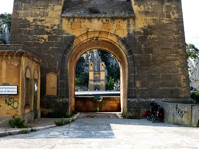
Old Pont de Mirabeau, River Durance (16:07)
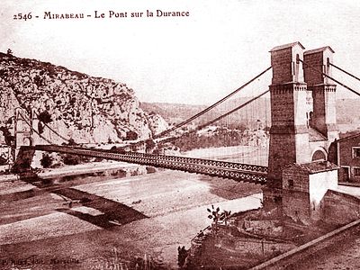
Pont de Mirabeau, 1845