Waseley Hills Windmill Café
Rea Valley Cycling/Walking Route
This is an off-road route along the River Rea Valley from Cannon Hill Park to Waseley Hills Country Park where the River Rea rises. Actually it’s more of a brook than a river, but never mind. The route is hard paved for nearly all its length, with the odd section of hard shale, but with no muddy grass. Basically follow the Sustrans Route 5 blue signs, being careful not to lose the track where footpaths split. The route leaves River Rea in order to get across the Bristol Road south of Northfield, but then finds its way back to the source of the river at Waseley Hills. There is a greasy spoon café at country park but during the Coronavirus lockdown this is not open, so take your own sandwiches!
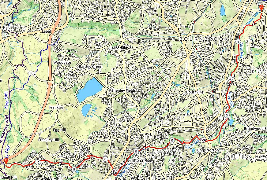
Rea Valley Cycle Route 11 Miles
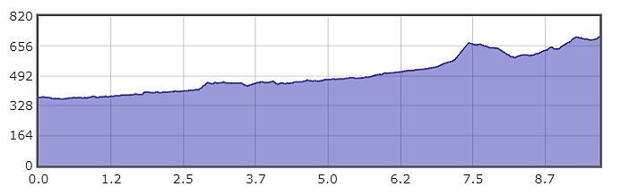
Profile
| Ascent | 571 ft |
| Start Elevation | 374 ft |
| Min Elevation | 364 ft |
| Max Elevation | 817 ft |
| Distance | 10.2 ml |