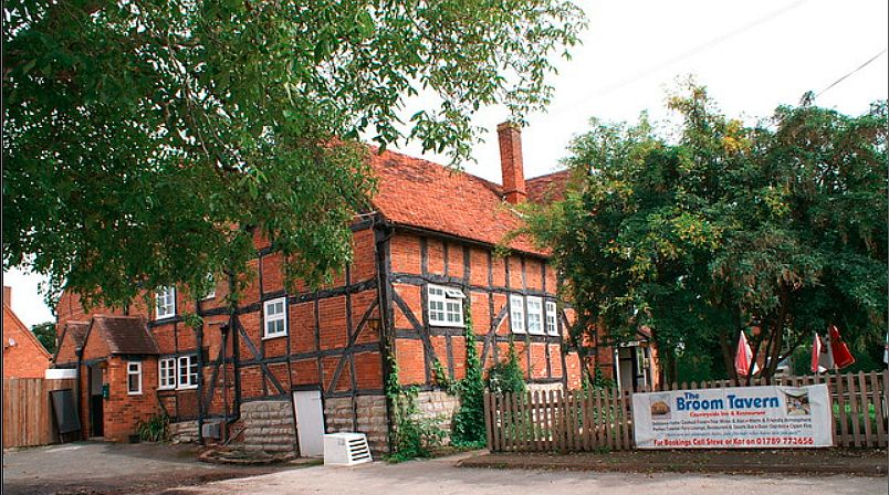
Broom Tavern, Broom
| Details | Value |
|---|---|
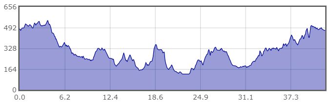
| Ascent | 1798 ft |
| Start Elevation | 482 ft |
| Min Elevation | 125 ft |
| Max Elevation | 548 ft |
| Distance | 43 mi |
| Download GPX file |  |
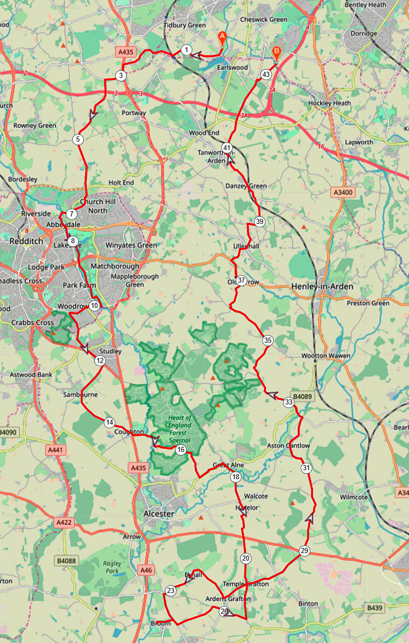
RLE to Broom, 22 September 2021
The direction I’d been given was due south, so as usual I looked for a pub between 15 and 20 miles away. I’d missed a ride to Broom some time earlier and thought it might be interesting to plan a route there, especially through Exhall, which is surrounded by attractive countyside.
The route starts by going to Earlswood railway station and then on to Inkford where it’s possible to take the underpass under the A435. Right turn after the caravan park to take the road towards Beoley, across the B4101 and then leave the road on the cycle path to the left, through Church Hill and on to the Arrow Valley path. A cunning deviation that I spotted on the map takes a seldom used road through Woodrow before joining the A448 for a mile or so, alongside Studley. The GPX file included goes towards the awkward junction with the A435. Carefully cross the main road and on towards Spernal, past the Purity brewery, Great Alne and on to Haselor and Temple Grafton. However, the map displayed shows an alternative route through Sambourne and Coughton that is quieter before joining the GPX route at Great Alne.
At the Temple Grafton cross roads turn right for Ardens Grafton and then keep right although the signs say it’s a no-through road. Swoop down a steep hill that’s a beast in the other direction and then through a delightful stretch of quiet lane through Exhall, straight on at the Wixford cross roads and right into Broom.
The return firstly goes due east, right, left and right again at the Golden Cross pub, then left up to Temple Grafton where it turns right at the cross roads and thereafter goes straight on at all junctions, past the Billesley Hall Hotel, through Aston Cantlow, Little Alne and Shelfield before turning right towards Oldberrow. There it joins the A4189 for about a mile and leaves it right towards Ullenhall, Danzey Green and Tanworth in Arden. Bear right at a ‘Y’ fork instead of entering Tanworth and then swoop down Tom Hill, under the railway line and steeply up the other side, carefully cross B4101, Broad Lane, and on to either Earlswood or possibly the Wedges Bakery for a coffee and a sticky bun.
The GPX file for this route will be found on the Club’s website: http://www.heartofenglandcyclingclub.org.uk/
RLE-Broom-43mi
21-09-22 profile