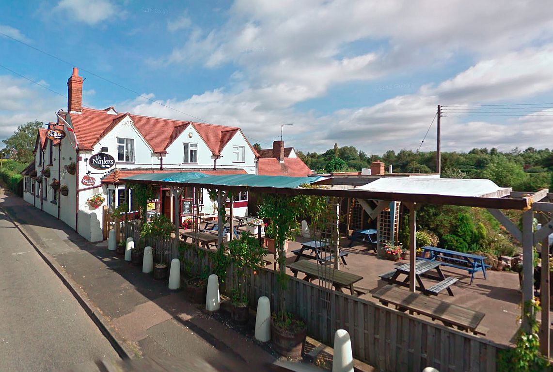
Nailers Arms
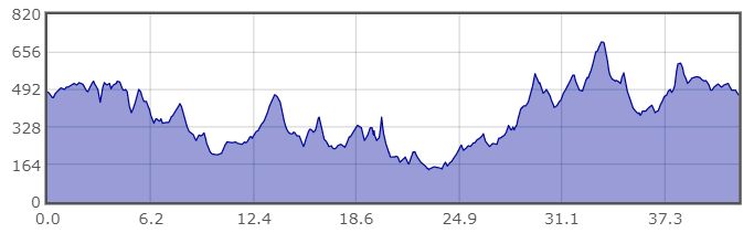
| Details | Value |
|---|---|
| Ascent | 2539 ft |
| Start Elevation | 482 ft |
| Min Elevation | 141 ft |
| Max Elevation | 699 ft |
| Distance | 42 mi |
| Download GPX file |  |
RLE to Bourneheath, 2 February 2022
The clocks had not yet sprung forward so I looked for a pub that was about two thirds of the way round so we could have a short afternoon. The route I was asked to follow was due west so I scrolled to the left on Open Street Maps and eventually rang the Nailers Arms in Bourneheath and confirmed that they could accommodate a number of cyclists for lunch at about one o’clock. The pub was actually three quarters of the way round, making an even shorter afternoon.
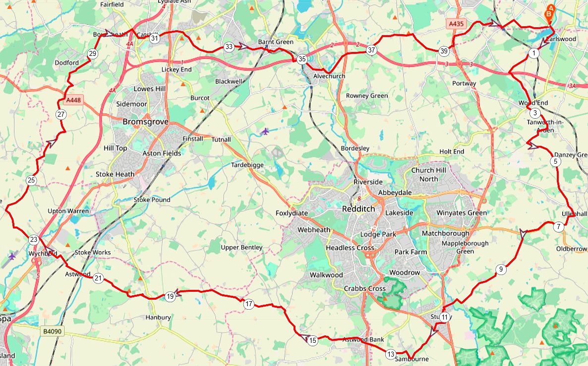
The route starts out across the Earlswood lakes causeway, over the motorway and takes a quick right and left across the B4101 before turning right in Tanworth in Arden. The route makes a short descent into a small valley and rises to a cross roads where it turns left to make the sharp descent to Ford Hall, steeply up the other side and then down to Ullenhall. Passed Ullenhall church the route turns right onto the main road to Redditch but leaves after a couple of miles at Outhill and then heads passed Studley Castle, through the back of Studley on designated cycle streets and on to Sambourne.
Turning left and then right through Sambourne the route rises to Astwood Bank, straight across the A441 at the traffic lights and steeply downhill to a dangerous right turn off the main road before taking quiet lanes to Ham Green and up Cruise Hill where the lane follows the ridge with open views on both sides. At the foot of the ridge the route turns right and follows through to the craft centre at Hanbury. The route now skirts round keeping clear Bromsgrove, through Wychbold and up to Dodford, eventually arriving at Bourneheath and the Nailers Arms.
The afternoon run is hilly, through Catshill, Barnt Green and Alvechurch before tackling Weatheroak Hill. At the top of this beast of a hill the route turns right all the way down to the A435, the Alcester Road dual carraigeway, where it is possible to ride through the underpass and then carefully cross the road and turn left up the footpath to Inkford. At the end of the footpath the route turns right to Tanners Green, left over the railway bridge at Earlswood Station and then first right down Wood Lane for Earlswood.
The GPX file for this route will be found on the Club’s website: http://www.heartofenglandcyclingclub.org.uk/
RLE-Bourneheath
22-02-02 profile