Day 5 – Route not followed
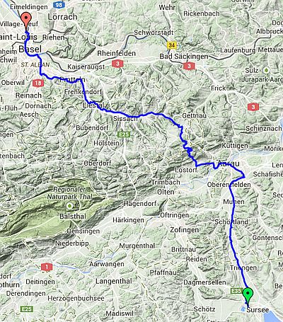
Sursee to Basel
| Route Statistics | ml / ft | km / m |
|---|---|---|
| Riding Distance | 56.05 | 90.21 |
| Total Ascent | 3268 | 996 |
| Total Descent | 4167 | 1270 |
| Start Elevation | 1713 | 522 |
| End Elevation | 814 | 248 |
| Min Elevation | 804 | 245 |
| Max Elevation | 1949 | 822 |
Campsite
Camping Au Petit Port, Huningue, France
Notes
I have left the day plans in place along with the GPX files that I had worked out from the detailed maps on the Swiss cycling website. Feel free to download them. I believe they are accurate although I haven't actually ridden them. They follow the OSMcycle trace that you can find on BikeHike and so far as I can see they match the Swiss Cycle Map exactly.
Day 5 – 56 Miles
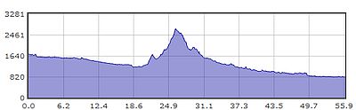
Gradient – Day 5