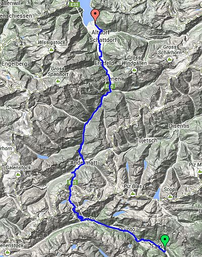
Day 3 – Route not followed
Chiggiogna to Altdorf
| Route Statistics | ml / ft | km / m |
|---|---|---|
| Riding Distance | 52.12 | 83.87 |
| Total Ascent | 7864 | 2397 |
| Total Descent | 8724 | 2659 |
| Start Elevation | 2300 | 701 |
| End Elevation | 1440 | 439 |
| Min Elevation | 1437 | 438 |
| Max Elevation | 6916 | 2108 |
Campsite
Remo-Camp Moosbad (http://www.eurocampings.co.uk/)
Notes
I have left the day plans in place along with the GPX files that I had worked out from the detailed maps on the Swiss cycling website. Feel free to download them. I believe they are accurate although I haven't actually ridden them. They follow the OSMcycle trace that you can find on BikeHike and so far as I can see they match the Swiss Cycle Map exactly.
Day 3 – 52 Miles
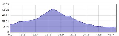
Gradient – Day 3