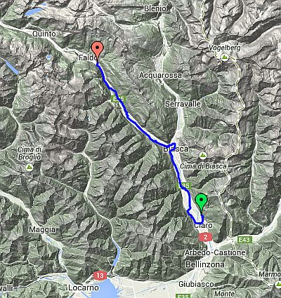
Day 2 – Route not followed
Claro to Chiggiogna
| Route Statistics | ml / ft | km / m |
|---|---|---|
| Riding Distance | 23.23 | 37.38 |
| Total Ascent | 2467 | 752 |
| Total Descent | 1099 | 335 |
| Start Elevation | 919 | 280 |
| End Elevation | 2287 | 697 |
| Min Elevation | 814 | 248 |
| Max Elevation | 2287 | 697 |
Campsite
Camping Gottardo (http://www.campingottardo.ch/)
Notes
I have left the day plans in place along with the GPX files that I had worked out from the detailed maps on the Swiss cycling website. Feel free to download them. I believe they are accurate although I haven't actually ridden them. They follow the OSMcycle trace that you can find on BikeHike and so far as I can see they match the Swiss Cycle Map exactly.
Day 2 – 23 Miles
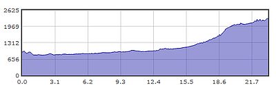
Gradient – Day 2