Day 4 – Route not followed
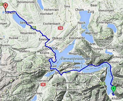
Altdorf to Sursee
| Route Statistics | ml / ft | km / m |
|---|---|---|
| Riding Distance | 53.02 | 85.33 |
| Total Ascent | 5397 | 1645 |
| Total Descent | 5121 | 1561 |
| Start Elevation | 1437 | 438 |
| End Elevation | 1713 | 522 |
| Min Elevation | 1388 | 423 |
| Max Elevation | 1949 | 594 |
Campsite
Camping Sursee (http://www.camping-sursee.ch)
Notes
I have left the day plans in place along with the GPX files that I had worked out from the detailed maps on the Swiss cycling website. Feel free to download them. I believe they are accurate although I haven't actually ridden them. They follow the OSMcycle trace that you can find on BikeHike and so far as I can see they match the Swiss Cycle Map exactly.
Day 4 – 53 Miles
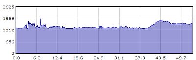
Gradient – Day 4