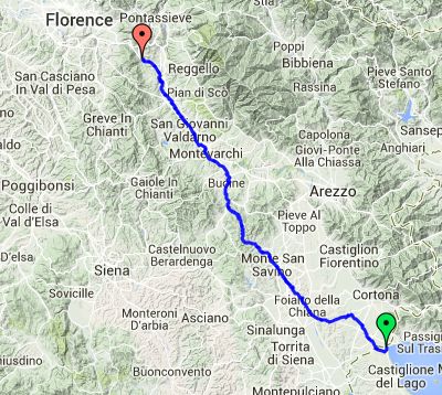
Day 5 – Saturday 19 July
Badiaccia to La Chiocciola
| Route Statistics | ml / ft | km / m |
|---|---|---|
| Riding Distance | 59.82 | 96.27 |
| Total Ascent | 3294 | 1004 |
| Total Descent | 3383 | 1031 |
| Start Elevation | 876 | 267 |
| End Elevation | 787 | 240 |
| Min Elevation | 377 | 115 |
| Max Elevation | 1539 | 469 |
Campsite
Camping Il Poggetto (http://www.campingilpoggetto.com/)
Notes
Today I wanted to get as close to Florence as possible so that I could get there during Sunday morning, find a place at Campeggio Michelangelo and then spend the afternoon sightseeing. It looked as though the route was hilly in the morning and flat in the afternoon, and so it was, though ‘hilly’ was an understatement.
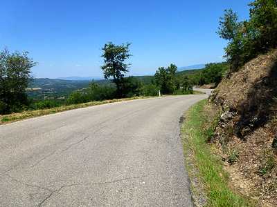
The OSMcycle route goes up to Arezzo where it meets the River Arno. It might have been sensible to do the same, but instead I took a direct route over a substantial peak at San Pancrazio. There I came to a standstill at a café where they made me a sandwich and I drank a couple of bottles of coca-cola. The temperature guage on my satnav showed 41°C and sweat was dripping off the peak of my baseball cap onto the satnav and mileometer, so I draped a handerchief over them to keep them dry. I had abondoned my cycling helmet as I couldn’t keep the sweat out of my eyes. I was sweating so much that the front of my cycling shorts looked as though I had had a nasty accident. The road surface was pretty lousy with deep cracks that hadn't been filled. When struggling slowly uphill they could be managed but freewheeling down you can’t just let the bicycle roll in case you hit an uneven bit at speed and do some damage, either to the bike or to yourself.
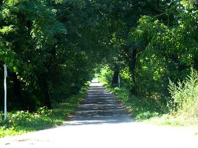
The road dropped quite steeply onto the Arno valley joining a main road at Montevarchi. The riding was suddenly delightful sweeping along quiet roads. At San Giovanni Valdarno there was a cycle track running along an embankment on the west bank of the river that I followed all the way to Figline Valdarno where it rejoined the main road. It crossed to the east side of the river near Matassino where it appeared to duck under the autostrada. I left the road and tried to follow it, but it deteriorated into deep sand and gravel pits, so I went back to the road.
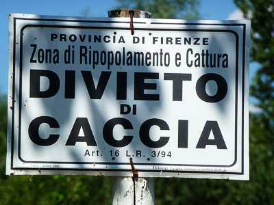
On the cycle track I had come across several signs that seemed to be prohibiting something but I couldn't get the gist of it from my Italian phrase book. It appears that it actually means “no hunting”.
There was a final steep climb along a main road with quite a lot of traffic until I arrived at the campsite, with a large metal arch over the entrance announcing it. It was another well appointed site with many cabins and lots of space for caravans and motorhomes. I was showed to my pitch by another cyclist and set up under the shade of pine trees. After washing and hanging my kit out to dry I went in search of a meal to replace the calories lost in the effort of the day. This was one of the best camp restaurants I came across, overlooking a swimming pool. In the end I couldn’t eat all that they gave me and I apologised and asked them to take the remainder away. The waiter misunderstood and packed the leftovers into a box and brought them back for me.
In the morning I had a splendid breakfast of bread, cheese, an orange and a litre of milk bought at the camp shop, eaten in the shade overlooking the swimming pool.
Day 5 – 60 Miles
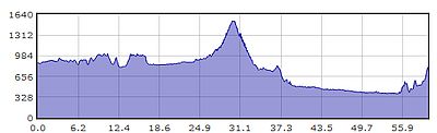
Gradient – Day 5
Crazed road surface near Montecchio (09:34)
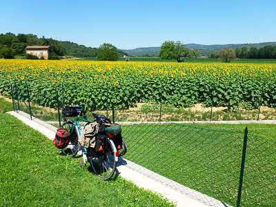
Sunflowers somewhere near Verniana (11:56)
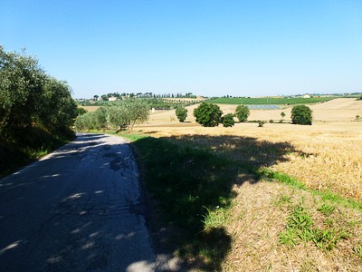
Coming down into the Arno valley near Capannole (12:57)
Arno cycle path near San Giovanni Valdarno (15:19)
“Area of Repopulating and Capture: HUNTING BAN” (15:27)

Under the Autostrada at Matassino and onto a doubtful cycle path?

Camping Il Poggetto