The Plan
Mike had suggested that we ride round the coast of East Anglia using mainly Sustrans routes, so we set about locating suitable camp sites at about 50 mile intervals and then plotting our route using internet-based route plotting applications to creat GPX tracks that we could follow on our sat-nav devices. The Sustrans routes do wiggle about a lot so occasionally we took short cuts where the roads were smaller but avoiding paths which looked very quiet from the map but which were probably not paved.
There was one occasion when we didn't follow that strategy and struggled up an overgrown sunken lane with a locked gate at the top that we had to climb over having first unloaded our bikes. As we were struggling over the gate the owner of the house at the top came out and said he had locked the gate to stop people using it, there being a new footpath close by that, obviously, we had missed – but I can't remember where that was.
The Plan
| Day | Campsite/Destination | Miles | |
|---|---|---|---|
| Start – Thu 1 Sep | Lakeside Caravan Park, Denver, Downham Market | 22 |

|
| Day 2 – Fri 2 Sep | High Sand Creek Campsite, Stiffkey | 52 |
|
| Day 3 – Sat 3 Sep | Waxham Sands Holiday Park, Horsey (Actually the Sutton Staithe Hotel) | 49 |
|
| Day 4 – Sun 4 Sep | Little Lakeland Caravan Park, Wortwell | 52 |
|
| Day 5 – Mon 5 Sep | Bright Meadow Caravan Park, Thurston | 45 |
|
| Day 6 – Tue 6 Sep | Cambridge | 42 |
|
| Total | 252 | ||
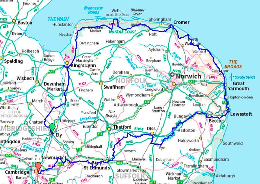
The Full Route (252 miles)
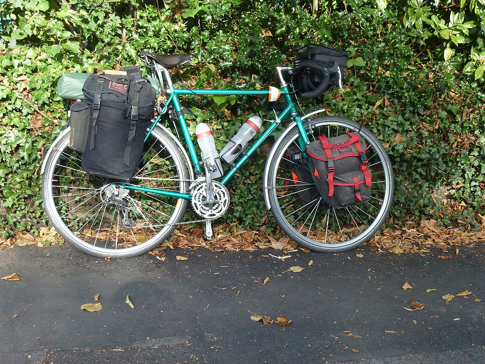
Loaded bike waiting for Mike